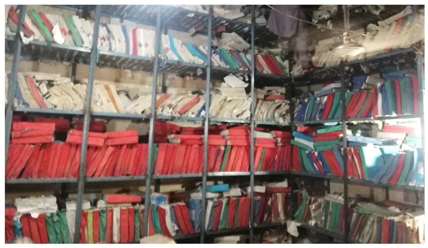
In Pakistan, matters related to real estate (land and any permanent structure on it) are still managed using traditional methods like handwritten maps on cloth (latha) by patwaris (village record keepers) in rural areas and paper-based drawings in urban areas. Most of the system is based on the local measurement unit of karam.
In contrast, countries like the Netherlands, Australia, Singapore, and others have advanced to sophisticated computerized systems using Geographic Information System, Satellite/Drone Remote Sensing, Electronic Measuring Distance (EDM) for surveying, Global Navigation Satellite System (GNSS), etc. Additionally, they are developing multi-story building models (digital twin) and Light Detection and Ranging (LIDAR) 3D point cloud data to develop smart cities for efficient urban development and real estate management.

One of the major social issues in Pakistan today is the inheritance and division of real estate and boundary demarcation, which has a foundation in joint ownership (khewat). The issues related to real estate have reached a critical stage. Take the case of Muhammad Ashraf from a remote village in southern Punjab. His grandfather’s inheritance of 4 acres of land was divided equally between his father and uncle 40 years ago.
This land, consisting of two plots, was divided amicably: the uncle chose the plot near the village, while the father took the one farther away. Ashraf’s father and uncle mutually agreed to exchange some land so that both brothers could have better locations for livestock fodder. However, this informal arrangement was never recorded in the revenue department’s official records.
Ashraf has five siblings, each of whom has four children. Similarly, Ashraf’s uncle has six sons and daughters, along with grandchildren, one of whom is Ashraf’s wife. Ashraf’s wife was also entitled to a share in the property from her father. The construction of a major highway near the land in 2013 exponentially increased its value, sparking a feud within the family.
With around 50 members now claiming equal rights to the most valuable portion, disputes escalated to court cases, severely affecting the relationships between the two families, including Ashraf’s marriage. The conflict negatively impacted their children, the extended family, and broader social dynamics.
In the same village, another dispute over the inheritance and demarcation of property between a nephew and his uncle has persisted for years. The resulting animosity has created such deep rifts that they avoid attending each other’s weddings and funerals.
These examples highlight the outdated and ineffective systems of the revenue department, which have transformed land disputes into a social crisis. The joint ownership system (khewat) is obsolete, and the lack of individual land demarcation has intensified family conflicts and social issues.
The Government faces significant revenue losses due to the undervaluation of real estate. In Rawalpindi city, which has 25 revenue zones, a single zone reported a loss of 23 million PKR in annual immovable property taxation due to undervaluation. For comparison, in 2017,Chennai, India—a city with a population of 10 million—collected more revenue from property tax than the entire Punjab province of Pakistan, home to over 100 million people.
Real estate disputes are among the leading causes of conflicts and violence worldwide, including in Pakistan. An estimated 50-70% of cases in Pakistan’s civil and high courts are related to land disputes, with additional cases in the revenue courts. According to the Punjab Land Records Authority, the number of land disputes in 2018 was approximately 200,000, dropping to around 100,000 in 2021.

The growing population and rapid urbanization have exacerbated real estate issues. Pakistan’s population has surpassed 250 million and is expected to grow further, with urbanization occurring at an annual rate of 3.6% compared to the rural growth rate of 1.9%. This surge has placed immense pressure on urban administration, particularly on outdated and manual real estate management.
In Punjab, where the agriculture sector dominates, 70% of the population is directly or indirectly linked to land for income. The province has 8,000 patwaris and other revenue staff managing the records of 20 million rural landowners in more than 25,000 revenue estates (mauza), excluding urban property records. Women face significant challenges in claiming their inheritance rights, and many are deprived of their legal shares.
According to a 2020 government report, only 17% of landowners were female in Punjab. A recent survey revealed that the primary causes of land disputes include fraud, joint ownership (khewat), and illegal possession. This is worth noting that many landowners and buyers are dissatisfied with the current systems, particularly with government institutions responsible for land administration.
Over a century ago, during the British colonial period, a land revenue system was introduced in South Asia to collect agricultural taxes from landowners. Laws like the Land Revenue Act of 1887 and the Land Registration Act of 1905 were established. However, these laws were primarily designed to exploit the local population and enrich the British Empire.
Despite gaining independence from British rule in 1947, Pakistan continues to operate under these outdated systems with minor modifications. The implementation of laws is very weak and not taken care of in general. For instance, the Ghouri Town development in Islamabad has been declared illegal by the Capital Development Authority (CDA). Yet, as shown in the image below, urban infrastructure development continues at a rapid pace in the area from 2005-2023.
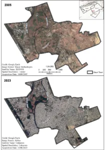
A Satellite image of Ghouri Town Islamabad (link)
Worldwide, land and property ownership rights are recorded either through a Title System or Deed Registration. In case of a property dispute, the Title System ensures the protection of the ownership rights of the current owner, while in the Deed Registration system, the owner must prove their ownership based on old records.
Under the Title System, the government takes responsibility for any loss to the owner’s ownership rights and provides compensation. Additionally, this system reflects ground realities, meaning any changes in ownership or boundaries of the property during its sale or purchase are immediately recorded as part of the system.
In Pakistan, however, Deed Registration and the Record of Rights (Registry of Landowners) are two separate records. The deed registration must be separately entered into the Record of Rights. Typically, the Record of Rights is updated every four years.
Modern land administration involves four key components:
- Land Tenure: Ownership and rights over land
- Land Valuation: Revenue collection from land use
- Land Use: Allocation of land for various purposes
- Land Development: Urban infrastructure and planning
Efficient and integrated land administration systems are crucial for sustainable development. In 2015, the United Nations introduced the Sustainable Development Goals (SDGs), aiming for global prosperity and environmental security. However, recent studies indicate that Pakistan lags significantly in achieving these goals, particularly in real estate management.
A recently published study has adapted the international standard Land Administration Domain Model (ISO 19152-2012) for Pakistan. There is a need to implement this model across all relevant institutions, including the Revenue Departments and Development Authorities in the country.
Efforts to modernize land administration are underway globally. Digital twins of urban areas and the establishment of smart cities are no longer futuristic concepts. In Pakistan, the first phase of land computerization (Land Record Management Information System-LRMIS) began in 2006, with Punjab, Sindh and KPK establishing land record service delivery centers.
The centres provide land mutation and ownership records (fard malkiyat). However, these centers only cater to rural land records, while urban records remain neglected.
Recently, the second phase of computerization in Punjab is launched as the Punjab Urban Land Systems Enhancement (PULSE) project with World Bank assistance. This initiative aims to digitize land records in urban areas and update Punjab’s land and property maps (masawi/latha/shajra parchah) using modern surveying methods and GIS.
In many areas of the recently merged tribal regions of Khyber Pakhtunkhwa and Gilgit-Baltistan, a formal system for managing land and property does not exist at all. Meanwhile, work on the second phase will still start in Balochistan, Kashmir, Khyber Pakhtunkhwa, and Sindh. It is essential that all provinces work together with cooperation, dedication, and efficiency while also keeping pace with global advancements.
This will ensure that the benefits of development quickly reach the common person. If this modernization of real estate is continued with consistency and sincerity, there is a possibility that sustainable social and economic development goals related to land and property can be achieved in the near future.