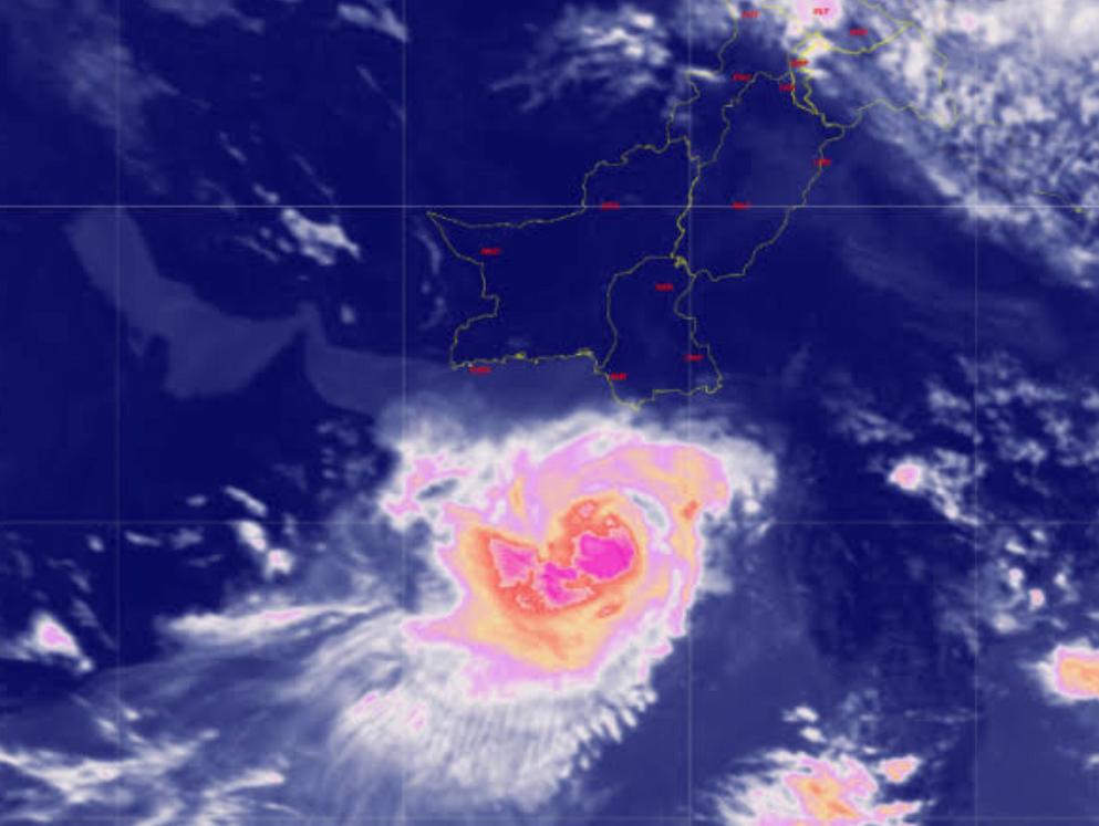
Tropical cyclone ‘BIPARJOY‘ has rapidly intensified into an ‘Extremely Severe Cyclonic Storm’ of Category 3, with sustained wind speeds ranging from 161 to 180 km per hour and gusts reaching up to 200 km per hour. Currently located approximately 580 km south of Karachi and 560 km south of Thatta, the cyclone is anticipated to continue its northward trajectory before curving eastward towards Keti Bandar and the Indian Gujarat Coastline. The affected regions are expected to include Thatta, Badin, Sajawal, Tharparkar, Karachi, Mirpurkhas, Umerkot, Hyderabad, Ormara, Tando Allah Yar Khan, and Tando Mohammad Khan.
The intensification and projected path of Cyclone ‘BIPARJOY’ have raised concerns among meteorologists and local authorities. The storm’s sustained wind speeds and gusts pose a significant risk to the coastal areas in its path. Preparations and precautionary measures are currently underway to mitigate the potential impact of the cyclone.
Residents in the anticipated affected areas are urged to remain vigilant and follow the instructions and advisories issued by local authorities. Measures such as securing loose objects, reinforcing structures, and stocking up on essential supplies are strongly recommended to ensure safety during the cyclone.
The cyclone’s projected path suggests a shift towards Keti Bandar and the Indian Gujarat Coastline, which necessitates preparedness in those regions as well. The potential impact of the storm includes strong winds, heavy rainfall, and storm surges, which can result in flooding, property damage, and disruption of essential services.
In response to the impending cyclone, disaster management agencies and relief organizations are mobilizing resources and coordinating emergency response efforts. Evacuation plans are being put into action to ensure the safety of vulnerable populations in the cyclone-prone areas.
Furthermore, the Indian and Pakistani authorities are working together to share meteorological data and coordinate response measures. Such collaboration aims to enhance early warning systems, response capabilities, and information dissemination to minimize the cyclone’s impact on both countries.
As cyclone ‘BIPARJOY’ continues to develop and approach the coastline, continuous monitoring of its path and intensity is crucial. Meteorological agencies are closely observing the storm’s movements and providing regular updates to keep the public informed.
Tropical cyclone ‘BIPARJOY’ has intensified into an ‘Extremely Severe Cyclonic Storm’ and is expected to impact coastal areas in the coming days. Residents in the potentially affected regions should prioritize their safety by following the guidance of local authorities and taking necessary precautions. Timely and coordinated response efforts can help mitigate the potential damage and ensure the well-being of the affected communities.