250 million years ago, the Earth had one continent and one ocean. Historically, it rested on tectonic plates, which are constantly moving due to radioactive processes within the Earth’s mantle. Over time, the movement caused the formation of seven continents.
Ocean trenches, volcanoes, earthquakes, and mountain buildings occur because of the movement of the plates. Earth consists of these plates, mainly the Eurasian plate, North American plate, South American plate, Arabian plate, Indian plate, Somali plate, Australian plate, Pacific plate, Philippine plate, etc.

The plate boundaries (fault lines) are categorized as Convergent, Divergent, and Transform. Convergent boundaries suggest that plates tend to move one into another, divergent ones move apart, and transform boundaries move horizontally. Saudi Arabia was torn apart from Africa due to the divergent nature of the Arabian and African plate boundaries, creating the Red Sea.
The world’s highest mountain peaks, including Mount Everest and K-2, are situated in Himalayan regions. The mountain range came into existence due to the convergent nature of the Indian and Eurasian plates. Both divergent and convergent phenomena happened millions of years ago.
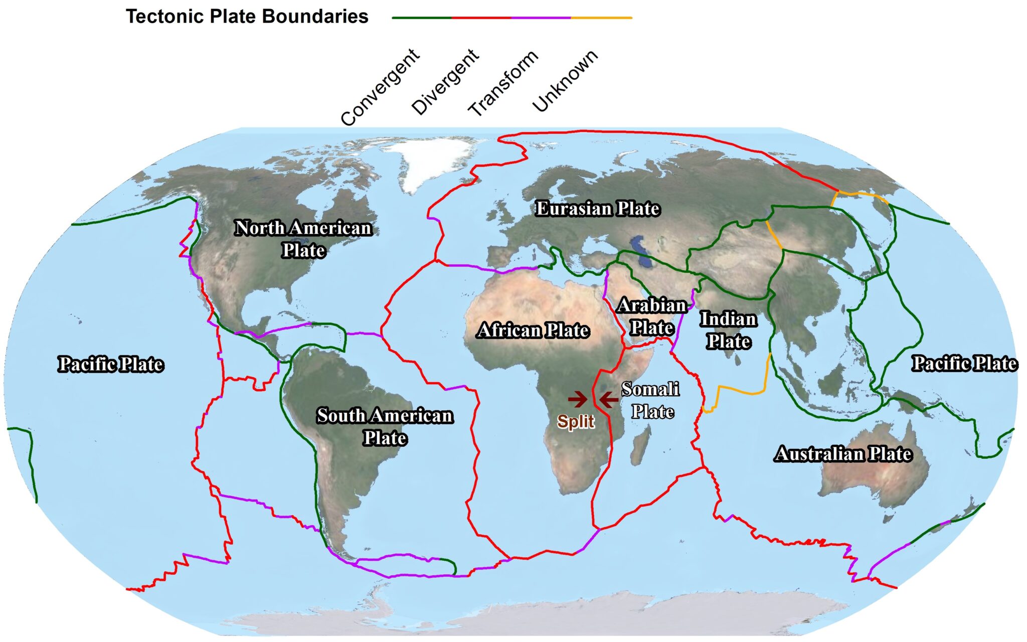
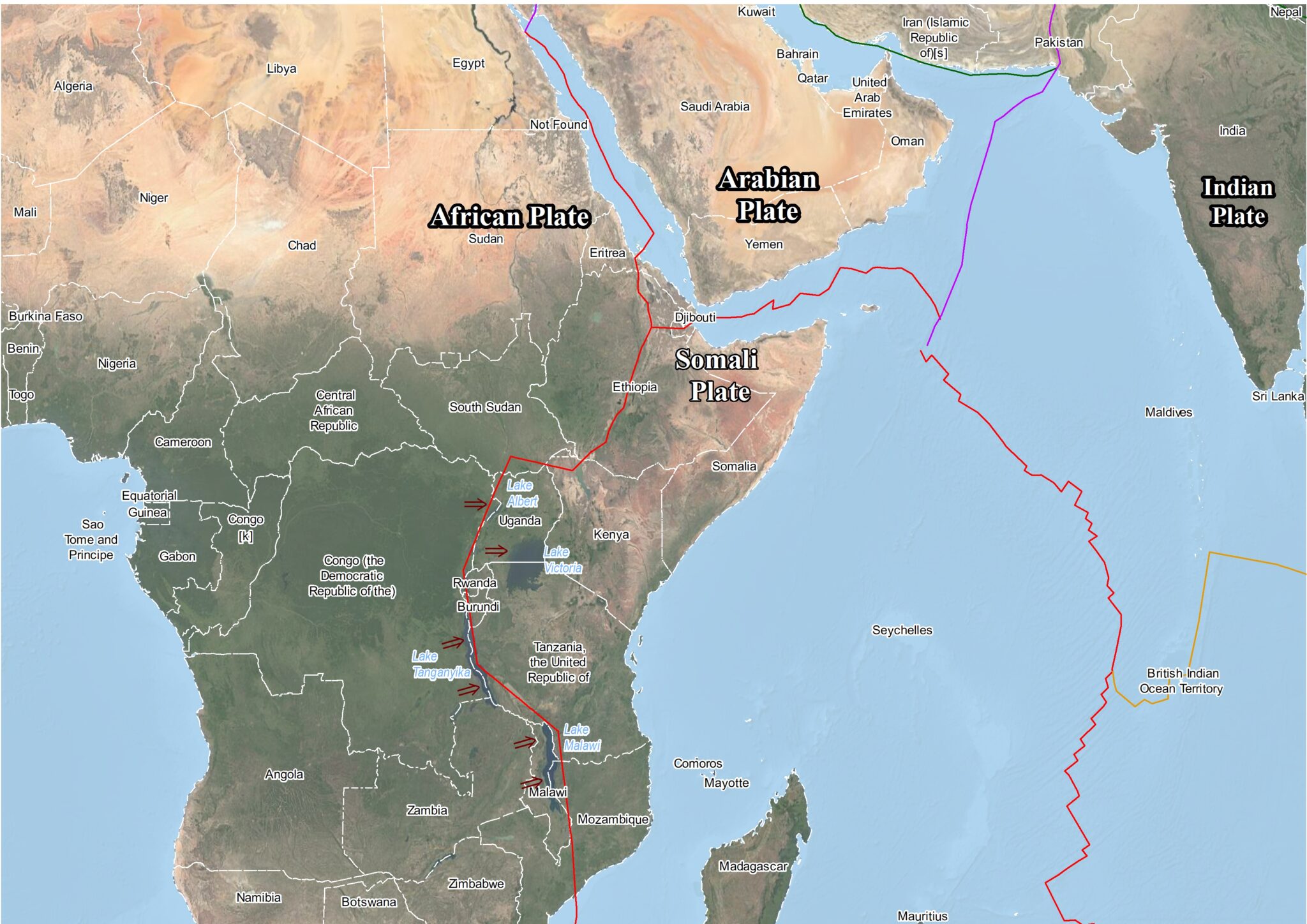
Due to the divergent nature of plate boundaries, the African, Somali, and Arabian plates are moving apart. The rift between the African and Somali plates is known as the East African Rift System (EARS). Due to the rift, there are lakes, including Lake Albert, Lake Tanganyika, and Lake Malawi. The rift can potentially cause the creation of a sixth ocean in Africa, where ocean water can flood from the Gulf of Aden through these lakes towards Mozambique in the south.
Read More: Real Estate: From Obsolete Record to Modernize System
However, the rate of plate movement is very slow (6-7 mm/year). Creating a new ocean and land mass will take over 10 million years. The geography of many countries, including Zambia, Ethiopia, Uganda, Congo, etc, will significantly change. A coastline and other economic activities will emerge for these landlocked countries.
The Global Positioning System (GPS) is a US-based navigation system that provides the precise location of any point on the Earth. The network of ground-receiving stations installed in the area also provided accurate location stations and distances among them with mm accuracy. In 2005, a GPS network installed along African and Somali plates confirmed that both plates were moving apart.